Showing posts with label Brookfield Power. Show all posts

Wednesday, August 6, 2014

Stone Valley Trail - Part 2

The dogs and I were hiking on the Stone Valley Trail, alongside the magnificent Raquette River. Summertime water levels were low, yet still there were waterfalls and rapids to add beauty to our excursion:

I couldn't maneuver the rocks because of my braces, but the dogs took great delight in exploring along the edges of the river:

In some places, the Raquette River was calm and quiet:

And the trail beneath the Hemlocks was peaceful:

Fergus trotted down to a pool of water:

I went as far as I thought I could manage, given my braces and the heat of the day, and then we turned back toward our parked car:

"This is fun, Dad. Come on down:"

Seamus isn't much for running and playing these days, despite having shed more than ten percent of his former body weight. Mostly he just follows along and looks happy:

We stopped to enjoy every scenic overlook:

And relished the cool shade of the forest. Back in the sun, the day was very hot:

We crossed back over the bridge which spanned the giant water pipe:

And I looked northward toward where the pipe was headed. It was an amazing sight. But our hike was over. We hurried back to the car, rolled all the windows down and got back on the road quickly to get the air flowing again:

Tuesday, August 5, 2014

Stone Valley Trail - Part 1

I'd been reading about the Stone Valley Trail for a long time and finally decided to give it a try. I drove down to the town of Colton, parked my car and began hiking at this dam on the Raquette River:

The trail is very long, but it was hot and my leg braces were bothering me, so I determined to walk as far as I figured I could and still make it back. The trail took us alongside this giant water pipe, part of the Brookfield power generating system:

And then across the pipe, leading us back toward the beautiful Raquette River:

We began in a mixed forest, angled downhill toward the river:

When we arrived at the Raquette River, the water level was very low:

My braces did not permit me to do much rock hopping, but the dogs sure had fun:

The dogs ran, played and refreshed themselves with river water:

There were many signs warning hikers to stay out of the river bed as the dam ahead of us could cause the water level to rise suddenly. I might have ignored the signs, but since I couldn't walk on the rocks with my braces anyway, I had to behave:

The low water level had exposed lots of rock formations:

In the forest, I saw numerous Indian-Pipe plants. Indian-Pipe is a parasitic flowering plant which derives its nutrients from a soil fungus which, in turn, gets its nutrients from tree roots. Because it doesn't need to manufacture its own food as most plants do, Indian-Pipe has no chlorophyll:

Seamus and Fergus paused for a breather:

And there were river scenes of spectacular beauty. But there was still more to see. I'll post Part 2 tomorrow:

Saturday, March 30, 2013

Discoveries Along Allen Falls Road

I turned onto Allen Falls Road to get to my next destination, the small settlement of Sinclair Corner. Along the way I passed over this massive pipeline, perhaps 6' in diameter. Since I'd seen them elsewhere, I felt quite sure that this was part of  Brookfield Hydro Power, utilizing the waters of the St. Regis River to produce electricity (note - I'd originally said it was the Raquette River, but a commenter corrected me):

I passed by this barn/garage/storage building:

And some nice rural homes:

Most all the homes were set far back off the road:

I stopped at "Ball Park North" for a photo but subsequent Google searches have not given me any idea what it was:

Ball Park North may have been a summer camp of some type as it had lots of log cabins clustered together beneath the trees:

This modular home was very far off the road:

And this home was quite close to the road:

There was a nice home surrounded by maples:

And what apparently was a second floor home atop a double garage:

An old barn with a dog out front who was determined to get to me. I snapped this photo quickly and drove away before he could get anywhere near me:

There were big old maples in abundance and I was almost to Sinclair Corner, about which I'll post tomorrow:

Wednesday, July 25, 2012

Hydro Power On Racquette River Road

It had been an active and interesting Monday morning up at the farm. I'd taken a photo tour of both Conifer and Sevey Corners, New York as well as hiking up to the Mount Arab fire tower. I was on my way back to the farm on Route 56 when I saw this sign for Joe Indian Pond. How could I resist? I turned down the road to find out more about Joe Indian Pond:

I never did find Joe Indian Pond, although I have since located it on a map. I suspect that, as is often the case up that way, the roads became so tiny and unmaintained that I didn't even recognize them as roads. I did, however, wind up on Raquette River Road, a long, straight, lonesome road which ran alongside the beautiful Raquette River. There were trees between the road and river for much of the way, but every mile or two I'd find an access road to a boat launch. I was stopping at nearly every one of them for a look:

The Raquette River seemed wide and placid, more like a lake. As I was to find out, that was because it had been dammed in many places to provide hydro-power:

This is one of the boat launches and a nice view of the river. These spots all had "No Swimming" signs, but I suppose that as remote and rural as this is, the local folks just do as they please:

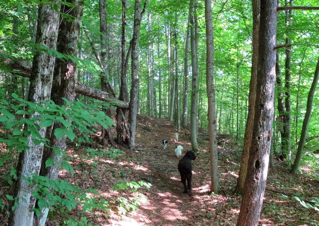
Daphne and Clover (notice the wet, straggly hair from our rainy hike up Mount Arab) were watching out the car window when we saw our first dam:

I drove farther along the river road and then up to the dam for a closer look:

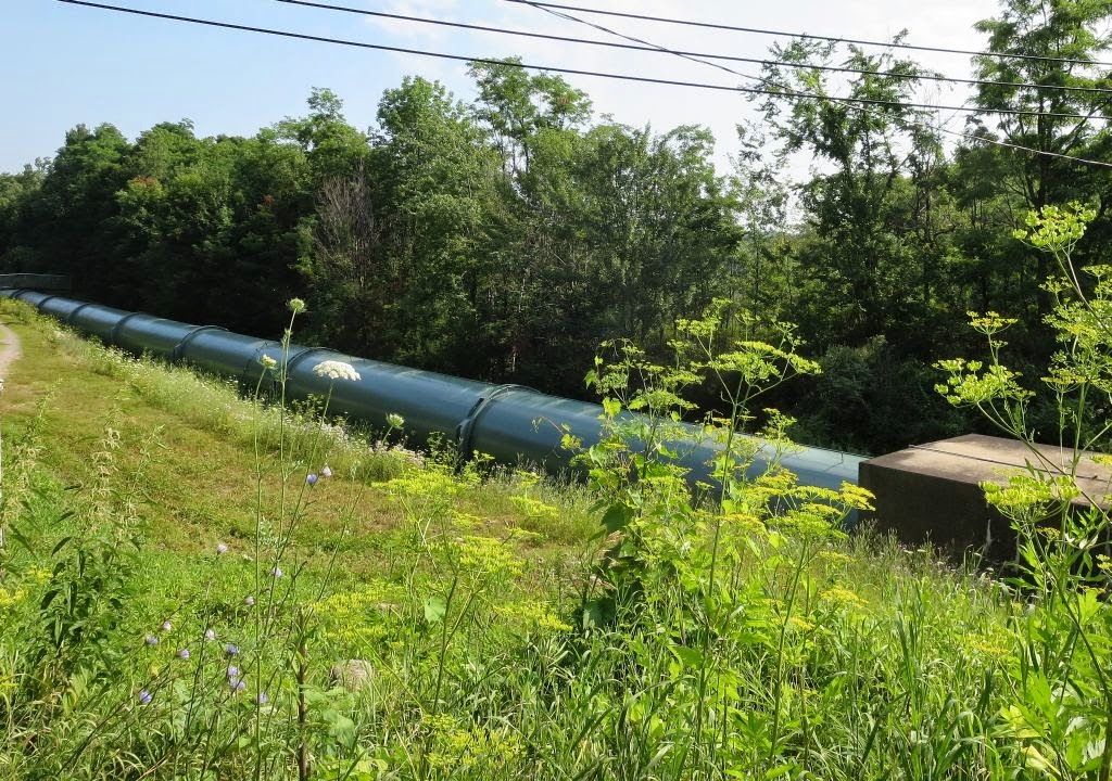
On the other side of the dam, most of the water was piped through a mammoth pipe:

All the way downhill to a hydro-power plant:

There were many of these dams, pipes and power plants all along the Raquette River:

And between each dam was a water access and boat launch provided by Brookfield Power. Each spot had a sign explaining that this public access was "Another Benefit Of Hydro-Power:"

I saw a series of such hydro-power plants, the last several including  large cylindrical buildings which I imagined were hydro-turbines:

And, amazingly, the Raquette River is still a wild and pristine river in many places. In this stretch, it is more like a series of lakes. But those "lakes," I'm sure, are wonderful recreation spots for local people, providing boating and fishing opportunities. But we were on our way home to the farm where old Wally and Winky awaited. I'll post more tomorrow: