The dogs and I were headed home, driving on Route 458 through the Adirondacks (see also Part 1, posted yesterday). I was stopping along the way to capture some of the early autumn color:
I almost drove past these cliffs, then stopped at this small, red sapling:
I backed up and found a safe parking spot to photograph some of the other scenery around the cliffs:
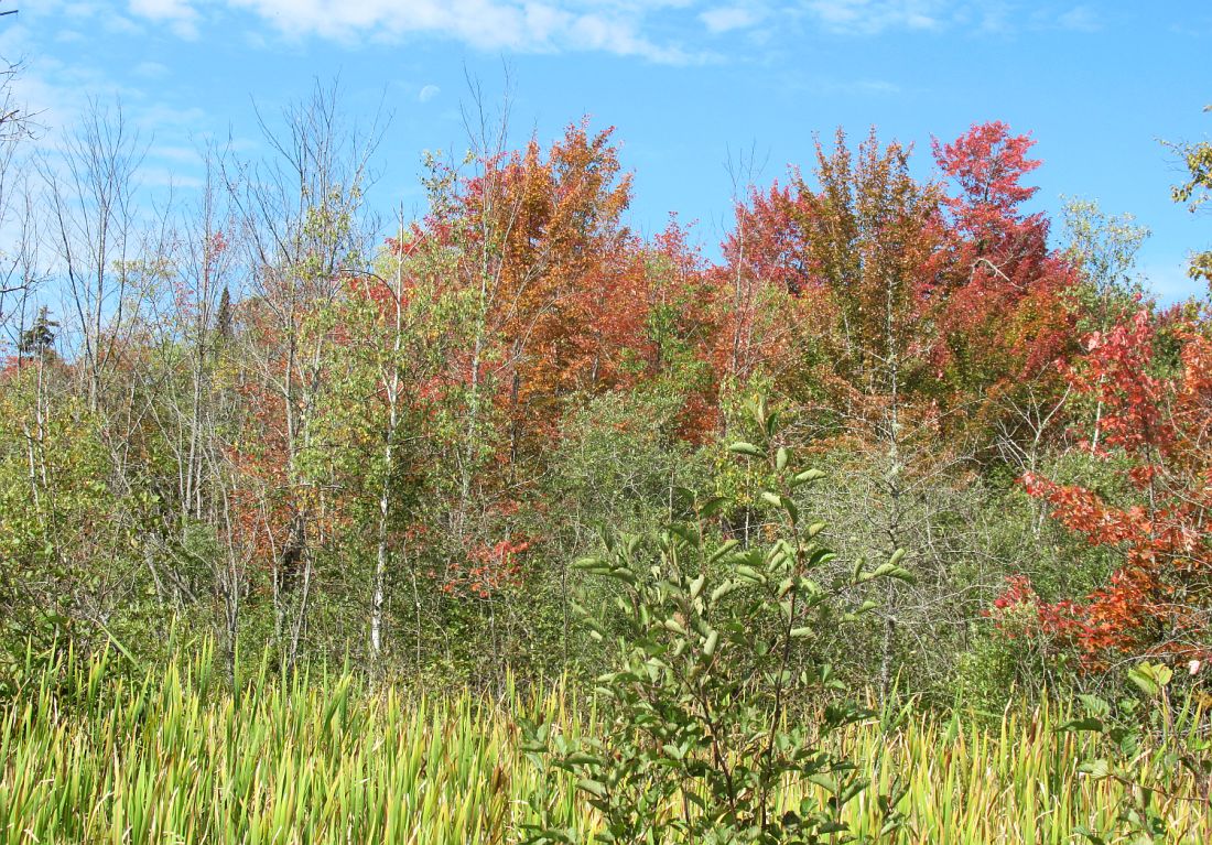
I'm not sure why the reds were so bright here, but I was thrilled to see them:
Driving through the Adirondacks in autumn is wonderful scenic experience:
I thought the colors would fade as we came down out of the mountains, but they were still bright:
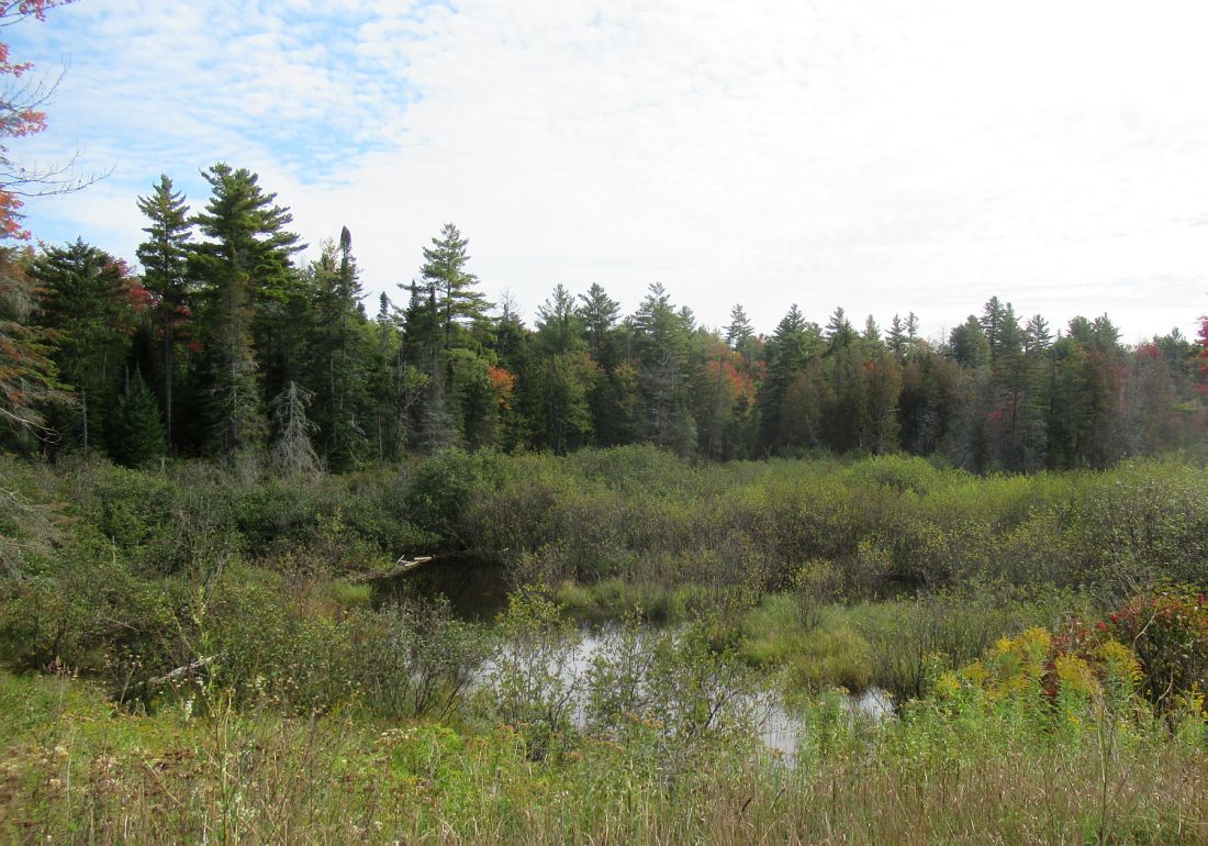
I took a small detour to drive along the St. Regis River and found this peaceful scene. Wouldn't you like to live here?
Mountain Ash beside someone's gravel driveway:
The three small dogs were watching out the front passenger window, the two bigger dogs were in the back:
Back on the highway again, I continued to find lovely autumn colors:
And a wide variety of species and mixtures. But of course I had to put the camera away and concentrate on driving home. It was time for lunch:
Showing posts with label Route 458. Show all posts
Saturday, October 5, 2019
Friday, October 4, 2019
Adirondack Autumn Color - Part 1
I'd just been out with dogs at Meacham Lake (see previous two posts), and we were on our way home. We were headed north on Route 458 through the Adirondacks and the autumn colors were just beginning to show. I decided to stop along the way and take some pictures:
Low mountains along the road:
A wet area beside the road helped turn these trees red:
One lone red tree among lots of green and yellow:
Not much color here, but it was a lovely marsh:
But there was certainly some bright color here:
And Staghorn Sumac can always be counted on to deliver bright red color in the fall:
More color along Route 458:
Much variety here:
Ferns beside the road were turning bronze and mixed with cattails. I'll post Part 2 tomorrow:
Labels:
Adirondacks,
autumn color,
Cattails,
driving tour,
ferns,
marsh,
Route 458,
Sumac
Tuesday, April 2, 2013
Route 458 On The High Northern Plateau
My weekend at the farm was over all too soon and I loaded all the dogs back into the car for the drive back home. The return trip began on Route 458 which passes through the magnificent Santa Clara Tract of forest:
There were about four logging operations along the road, with this one being the largest header I've ever seen:
Here's a closer look. That's a lot of wood, but it seemed too small for lumber. I guessed that it was pulpwood, most likely headed to a pulp mill somewhere in the area:
And back in the trees was this cluster of tiny, old cabins. They may have been hunting cabins or perhaps a logging camp many years ago:
Route 458 stretched out along the high Adirondack northern plateau, with mountains rising up on every horizon:
There was what I believed to be a road maintenance garage:
And wetlands alongside the road with snow covered mountains in the background:
Someone's camp or home, set back in the trees:
This old bridge always fascinates me when I see it. I suspect it was once a part of the road which has now been replaced by Route 458. Perhaps now it is used by the Adirondack Park Agency or maybe it is a private lane used by landowners. Either way, it's a beautiful sight:
Clover watched out the window as we passed a creek, bubbling its way through the snowy highlands:
It sure looked cold out there!:
The road crossed the St. Regis River which has several branches and seems to be everywhere. But it's wild and beautiful. And right about there we encountered the small town of Santa Clara, New York. But I'll post about that tomorrow:
Wednesday, January 30, 2013
The High Peaks In Winter, Part 2
I was on Route 73, driving through the High Peaks Region of the Adirondacks, on my way to a visit to the farm. The dogs and I had passed through the Giant Mountain region and began dropping down into the Keene Valley:
Daphne and Clover watched the passing scenery with interest:
We passed through the hamlet of St. Huberts:
There was a deep chasm right next to the road and then more mountains:
And once we were in the Keene Valley, there were flatlands surrounded by mountains:
A few farms have survived in the Keene Valley, but mostly it is now a place for tourists:
And the old barn I photograph on nearly every trip:
When we reached the high plateau of Route 458, the scenery became different but altogether gorgeous, kind of like driving through the Black Forest:
My front seat buddies:
And then, just ahead of me, I saw a Bobcat slowly crossing the road, not overly concerned with me or my car:
I pulled off the road onto the shoulder in order to watch his progress into the forest:
He became a little bit nervous after I'd stopped to watch him. When he reached the trees, he positioned himself behind one of them, stuck his head around the tree trunk and watched me suspiciously. The dogs never seemed to notice him, which was a good thing as they'd likely started barking. But we were close to the farm at that point and I pulled back onto the road to finish the journey:
Sunday, December 30, 2012
Route 458, The High Northern Plain
We were almost to the farm and had reached Route 458, which runs between Route 30 (north of Paul Smiths) and the town of Hopkinton. Route 458 is on a high northern plain, still part of the Adirondacks and with mountains visible all around, but rather flat compared to most of the area. It is surrounded by boreal forests and wetlands. There was no snow on the ground that December day but the surrounding mountains all looked sugar coated:
Madeline and Clover figured that if I'd stopped the car and rolled down the window, there must be something interesting out there. Notice little Madeline's reflection in the car's side-view mirror:
Broad wetlands stretched alongside the road in many places, interspersed with northern forests, and some of the wetlands had nearly completed the sphagnum caused return to solid ground:
I've passed by this sign many times without so much as slowing down, but on that day I stopped for a look. Jennings Road. Did that refer to Route 458 or that little dirt lane into the forest? I can find no answer on Google. The next photo is enlarged and easier to read:
Here is a closeup of the sign. This area was important in the war of 1812. I found references to the "Jennings Clearing" or "Jenning's Place," both referring to an encampment of U.S. troops during the war. Perhaps I'll just have to walk that road. There's a gate there, but I can still walk it if there's no "No Trespassing" signs:
A look at what may or may not be the old Jennings Road. If that's it, there should be a clearing back there with grave sites. But on that day I was in a hurry to get the farm and we'd already done enough exploring along the way. So I continued on Route 458 and left this mystery for another day:
Subscribe to:
Posts (Atom)